
Remote Sensing-Based Assessment of Pastureland Degradation in Atyrau Oblast, Kazakhstan
Asyma Koshim , Kanat Samarkhanov, Aigul Sergeyeva, Aliya Aktymbayeva, Kazhmurat Akhmedenov , Aisulu Otepova , Aina Rysmagambetova,Kyrgyzbay Kudaibergen
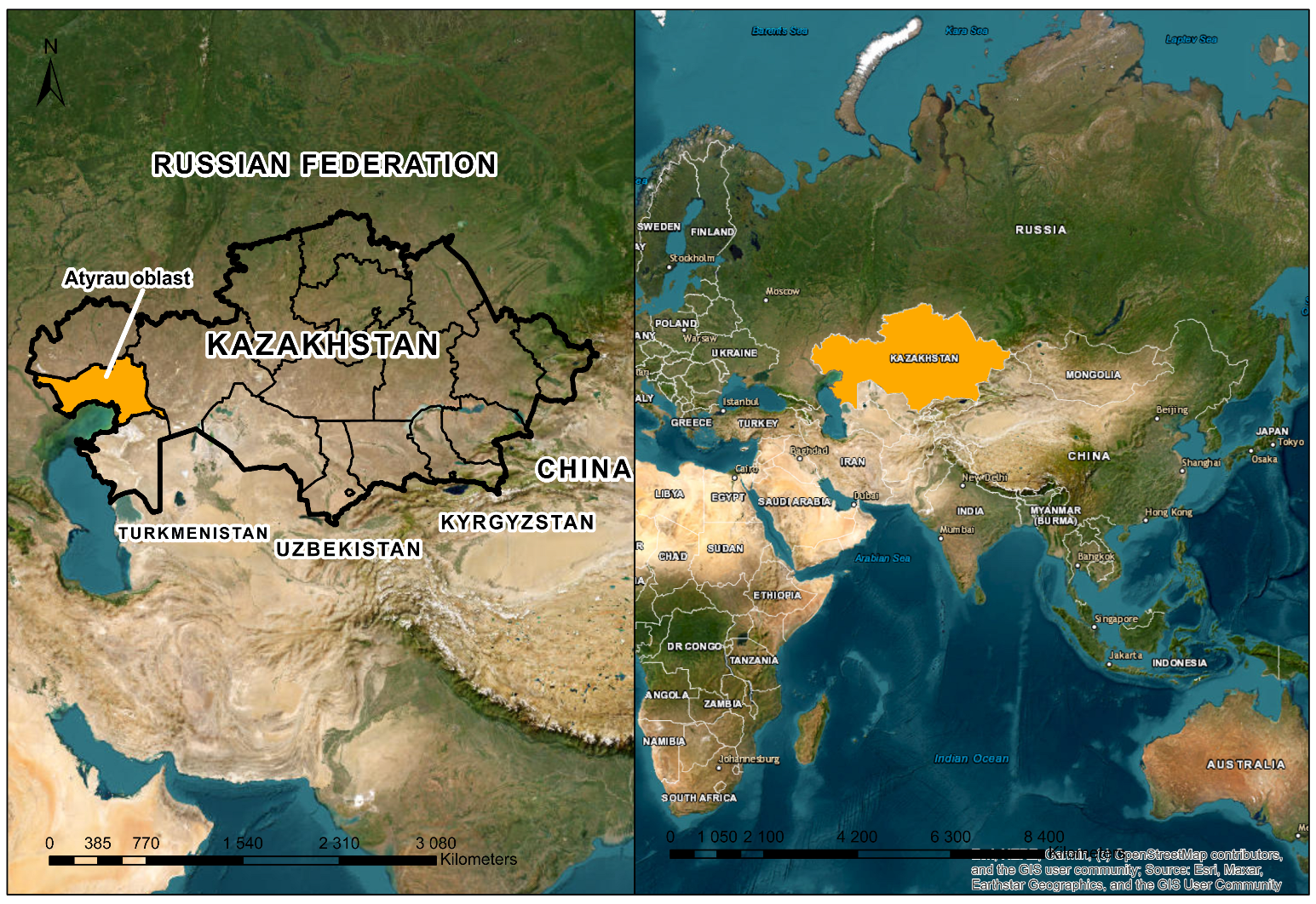
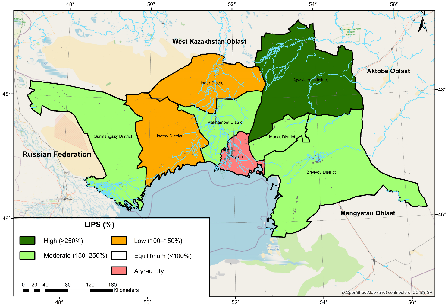
Pasture ecosystems in the arid regions of Kazakhstan are highly vulnerable to the combined effects of climatic variability and increasing grazing pressure, while long-term spatial assessments of degradation remain limited. This study develops an integrative remote sensing-based framework for assessing pasture degradation in Atyrau Oblast by combining long-term NDVI time series (2000–2023) with grazing pressure indicators (Ksust and LIPS), field observations, and climatic data. The results show that 49.3% of pasturelands are degraded, with statistically significant negative NDVI trends observed across most administrative districts. Areas experiencing pasture overload (Ksust > 1.2) spatially coincide with persistent vegetation decline, and significant negative relationships between NDVI and livestock numbers are identified in several districts. The analysis also reveals spatial heterogeneity and lagged responses of vegetation dynamics to grazing pressure under varying climatic conditions. The proposed approach provides a novel integrative framework that links spectral vegetation indicators with climate-adjusted grazing metrics, enabling the identification of degradation hotspots and supporting spatially differentiated pasture management. This framework can be applied in regional land monitoring systems to improve decision-making for sustainable rangeland use under climate change.
Reference to the article:
Koshim, A.; Samarkhanov, K.; Sergeyeva, A.; Aktymbayeva, A.; Akhmedenov, K.; Otepova, A.; Rysmagambetova, A.; Kudaibergen, K. Remote Sensing-Based Assessment of Pastureland Degradation in Atyrau Oblast, Kazakhstan. Sustainability 2026, 18, 3905. https://doi.org/10.3390/su18083905


